Now hiring | Multiple roles
View active rolesNow hiring | Multiple roles
View active roles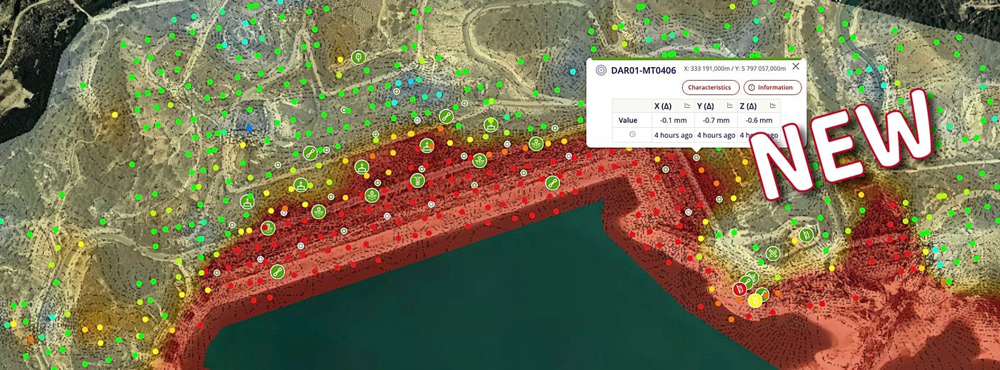
Monitoring Information Management System (MIMS)

Setting a new standard in Construction and Infrastructure monitoring.
Beyond Monitoring™ is a state-of-the-art Monitoring & Information hub.
At Sixense, we’ve used our 20+ years of experience monitoring software development with Geoscope™️ to create a ground-breaking platform. The platform defines new construction and infrastructure monitoring standards with cyber security as a priority. From intelligent automated processes to full customisation capabilities, the platform is truly versatile and will suit several needs. It is built for projects of any size. Still, it is particularly well-suited to large projects where different types of sensors are consolidated for analysis.
Some of the prestigious early adopters choosing Beyond Monitoring include the Suburban Rail Loop Authority in Melbourne, Transport for New South Wales, and OZ Minerals in South Australia.
Beyond Monitoring™ is a state-of-the-art Monitoring and Information hub. Our platform focuses on keeping all sensors’ data in one easy-to-use location.
This data hub manages all types of data with an emphasis on quality and real-time monitoring. Geotechnical, Structural and Environmental sensor data are the most common types, but any sensor data can be acquired.
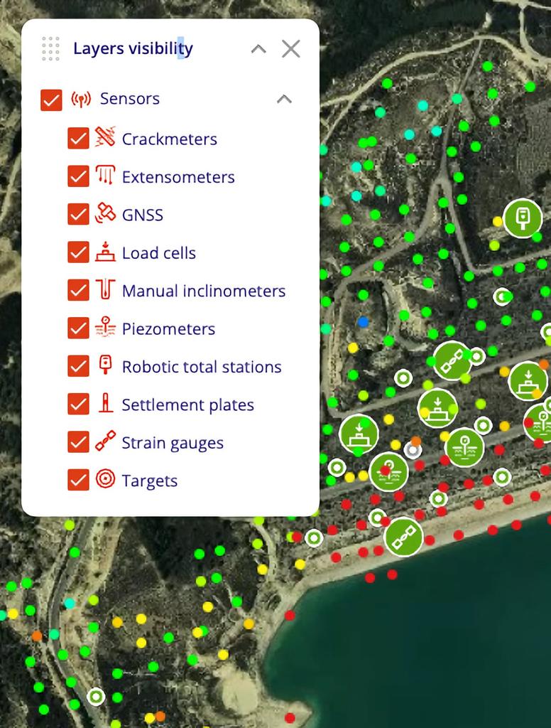
The list of pre-configured sensor includes:
Beyond Monitoring™ is versatile and equally suited to small projects with a few sensors and large and complex projects with thousands of sensors.
Being able to smoothly handle a few million data points from Atlas-InSAR was one of the non-negotiable specifications of the platform and the result is above expectations.
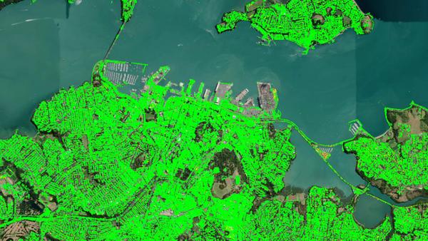
One of our projects in Auckland is generating 7,600,000 data points every 11 days and has been running for 30 months. Navigating this substantial database to locate and analyse critical areas is straightforward.
The platform is scalable with high responsiveness and performance, either for a small geotechnical project, a large tunnel construction, or a critical dam surveillance program.
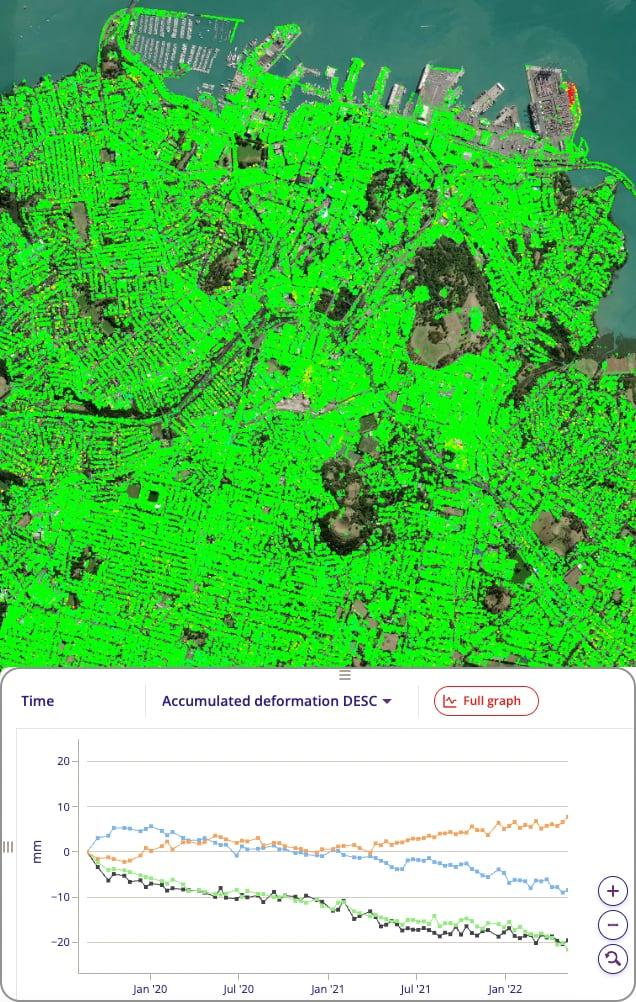
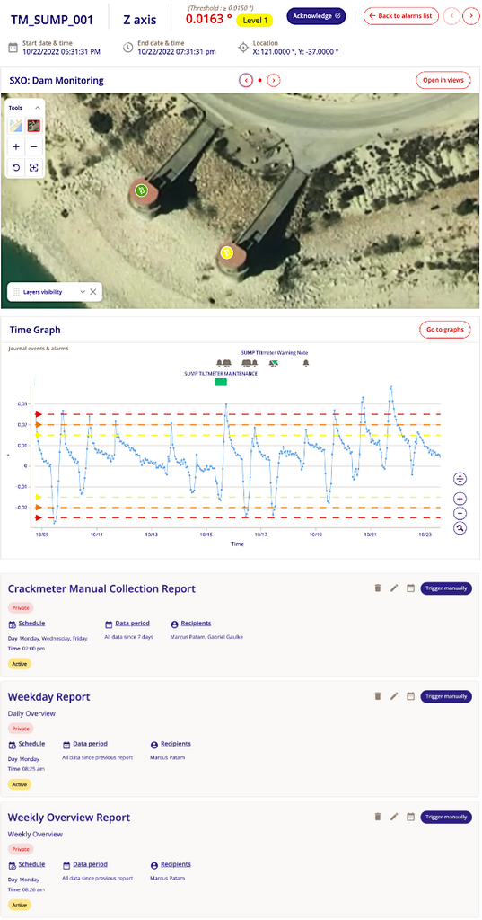
Alarm managmeent is a powerful module of Beyond Monitoring suite allowing for a global definition and management of the alarms, whatever the origin and type of the data (Geotechnical, Structural, Environment). It grants the stakeholders a unique, customised and flexible interface to assess the situation and make the appropriate decision.
Alarms are accessible from different ways. However, the system includes a central dashboard gathering all ongoing alarms plus a logbook for traceability and quality purposes.
Reporting is an essential component of a monitoring programme. With alarm managment, it's often the only visible part of monitoring programme for many users and managers. Beyond Monitoring™️ pays particular attention to the reporting module. Generic templates for daily, weekly or monthly reports are provided and customisable, but the data manager can also create its own. Reports are then triggered manually or automatically following a predefined schedule. Users of the recipient list then receive the reports directly in their inboxes.
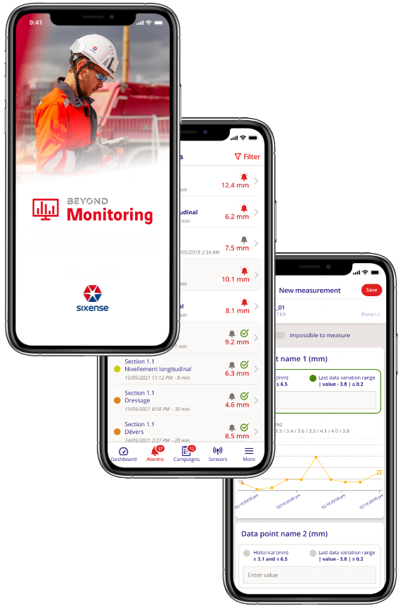
Beyond Monitoring is deployed with a mobile app (IOS & Android) dedicated to alarm management and manual data collection campaigns.
Alarm notifications are pushed to the app, where sensor maps and time series data are available for review. Users are then prompted to acknowledge the alarm with comments and photos, if necessary.
Manual data collection campaigns are created on the web interface and scheduled tours are assigned to users. Consequently, it’s convenient for the technicians to follow a tour guided by the GPS locations of the sensors to collect the required data. To avoid any error, the sensor data is immediately displayed on the phone and compared to previous data to assess continuity. A QR code linked to the sensor is also provided for automatic identification.
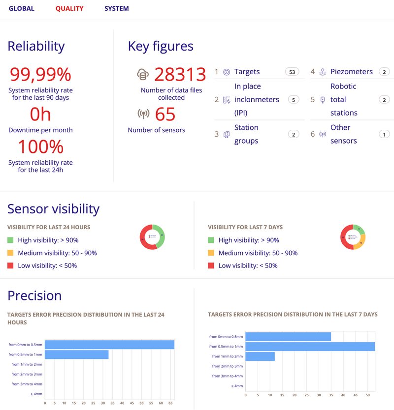
To further inform the quality of the monitoring system, project dashboards are embedded providing up-to date information on project KPIs, such as system reliability, sensor quantities, visibility, and measurement precision.
• It’s easy to track global changes to the monitoring system, whether degradation or improve-ment, in a single place.
• A dedicated dashboard allows you to track Automatic Total Stations (Cyclops), which includes features such as prism visibility and drift.
• All this allows the Instrumentation & Monitoring Manager to focus on what's essential: Availability, Reliability and Data Quality.
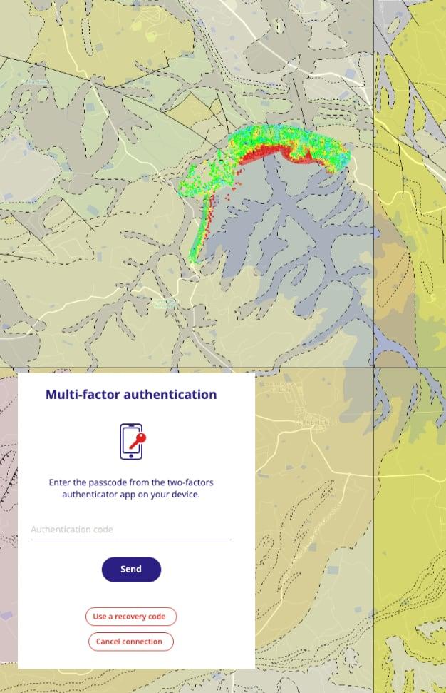
As a 100% web-based GIS system, Beyond Monitoring™️ offers a high level of versatility. It can include any web map service - like the site’s geology - to enhance the views, which helps users better understand the sensor data.
Beyond Monitoring™️ is proposed as Software as a Service (SAAS) hosted in the Cloud. The platform has several layers of security implemented to guarantee the integrity and the confidentiality of all of all stored, processed, and transferred data. All data hosted within Beyond Monitoring is encrypted per that HTTPS TL1.3 protocol.
In addition, the application is fully protected by two-factor-authentication (2FA) sign-in using JWT tokens.
Furthermore, the Beyond Monitoring environment is under the process of ISO27001 certification.
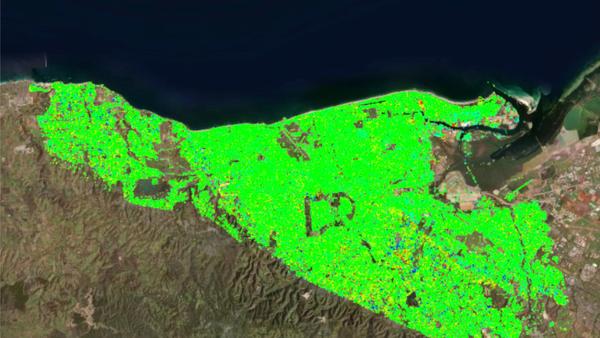
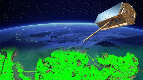
Around Auckland, we are already starting to see higher temperatures, increased drought, more intense rainfall events and sea level rise. We expect more change over the next 100 years. Also Auckland Council has declared a climate emergency and established a plan to prepare Auckland for the impacts of climate change
The Auckland area is subject noticeable ground movements and to analyse the impact of the climate on the ground deformation, Sixense as provided Atlas- InSAR high resolution data over the extended metropolitain Auckland.
The delivery was completed by advanced data analytics to extract the important information form this "big data" set.
Measurement Pts
Surface
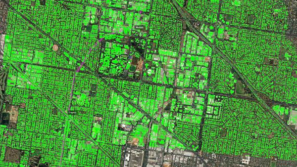
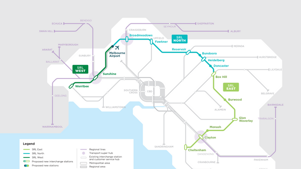
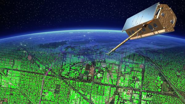
The Suburban Rail Loop (SRL) is an orbital line of the rail tunnel network of Melbourne, which will traverse suburbs 15–25 kilometres from the Central Business District (CBD) along an approximately 90 km route. Stage 1 between Cheltenham to Box Hill is underway to construction.
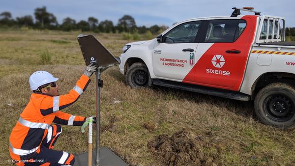
Sixense is providing extensive baseline monitoring over the tunnel alignment and surroundings with Atlas- InSAR medium and high resolution. To complete the monitoring scheme, a set of Artificial Corner Reflectors (ACR) has also been installed to provide measurement data, either on green field where traditional InSAR processing is more limited, or on critical areas/points.
Measurement Pts
Duration
Artificial Corner Reflectors
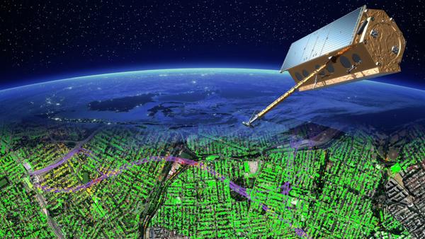
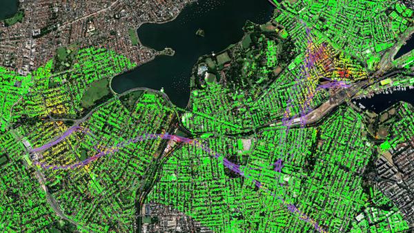
WestConnex is a 33-kilometre predominantly underground motorway scheme in Sydney. The full project is divided in seven diffrents packages with construction staged over a decade.
Sixense is providing Atlas-InSAR monitoring at high resoluton over the span of the projects.
Measurement Pts
Duration
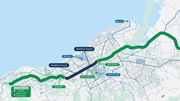
The 10.5 km Torrens to Darlington (T2D) tunnel project is the final piece of one of Adelaide’s most important transport routes, the North-South Corridor (NSC).
In order to gain a clearer understanding of the initial conditions, the Department of Infrastructure and Transport (DIT) enlisted Sixense to conduct historical ground deformation monitoring along the tunnel alignment. At the end, we ended up analysing the entire Adelaide Basin. This provided the team with invaluable data for their geotechnical analysis.
Surface analysed
Historical period
InSAR measurement points (PSI)
Measurement layers
