Now hiring | Multiple roles
View active rolesNow hiring | Multiple roles
View active roles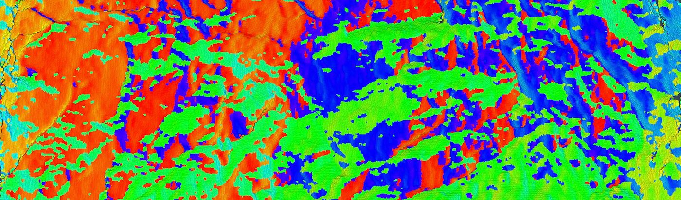
Digital Tunnel Face Mapping

DIY accurate 3D modelling of tunnel faces with automatic photogrammetry processing.
When excavating tunnels in complex geology using drill and blast technology, mapping the successive tunnel faces is necessary to better understand the structure of the underground.
We've developed a fully digital solution for tunnel face mapping using high resolution photogrammetry.
Our solution is a comprehensive package that gives you the capability to create yourself accurate 3D models of tunnels face in minutes.
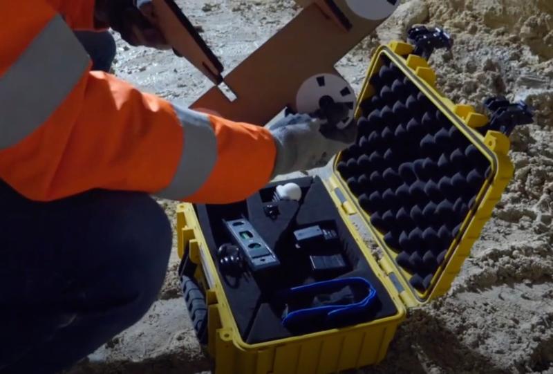
We provide a comprehensive hardware kit and training so you can take photos yourself.
The characteristics of the kit depend on a combination of the diameter of the tunnel and accuracy you are looking for.
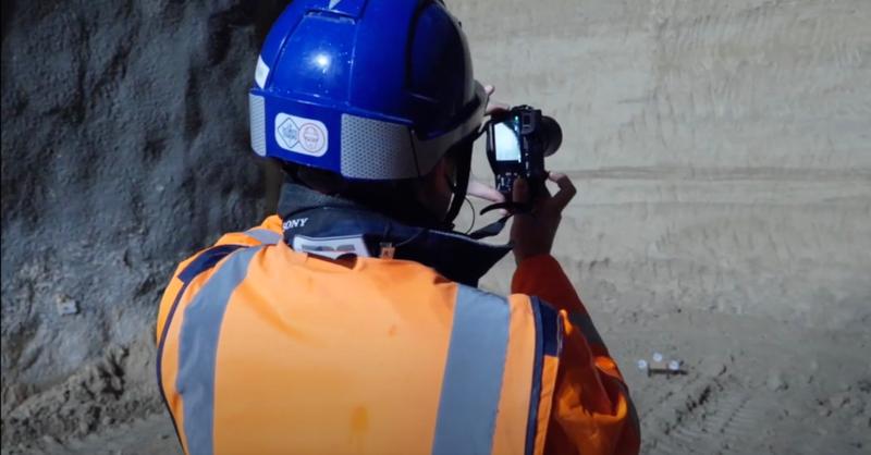
Take successive photos following the procedure to ensure necessary overlap of 70% between the photos.
Then directly upload the set of photos to the beMap platform and the photogrammetric process will automatically start.
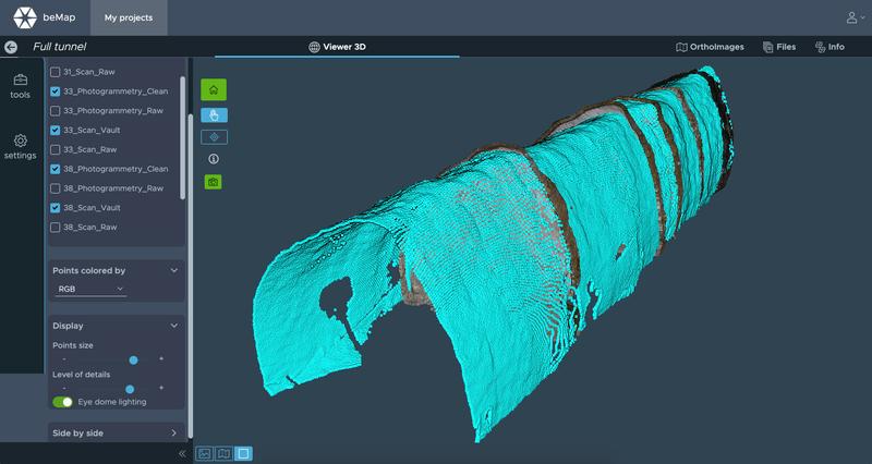
Depending on the size of the tunnel after only a few minutes the system generates a georeferenced, high resolution and accurate 3D model of the tunnel face, ready to analyse.
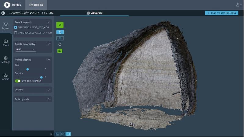
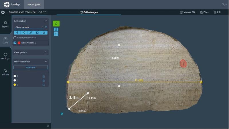
beMap includes a tool-box to analyse your model: Distance, angle, strike & dip, comparison, annotations, etc...
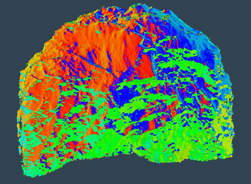
A semi-automatic machine learning module allows for the mapping of the geology of the face. This digital solution is not only more accurate than the traditional approach with pen and paper, but it can also save a lot of time.
Additional georeferenced scanning of the tunnel and consolidation with face photogrammetry provides the complete mapping of the structure and its geology.